Industrial gas burner system with red units and yellow pipes in a technical facility.

Utility Investigation - Damage Prevention

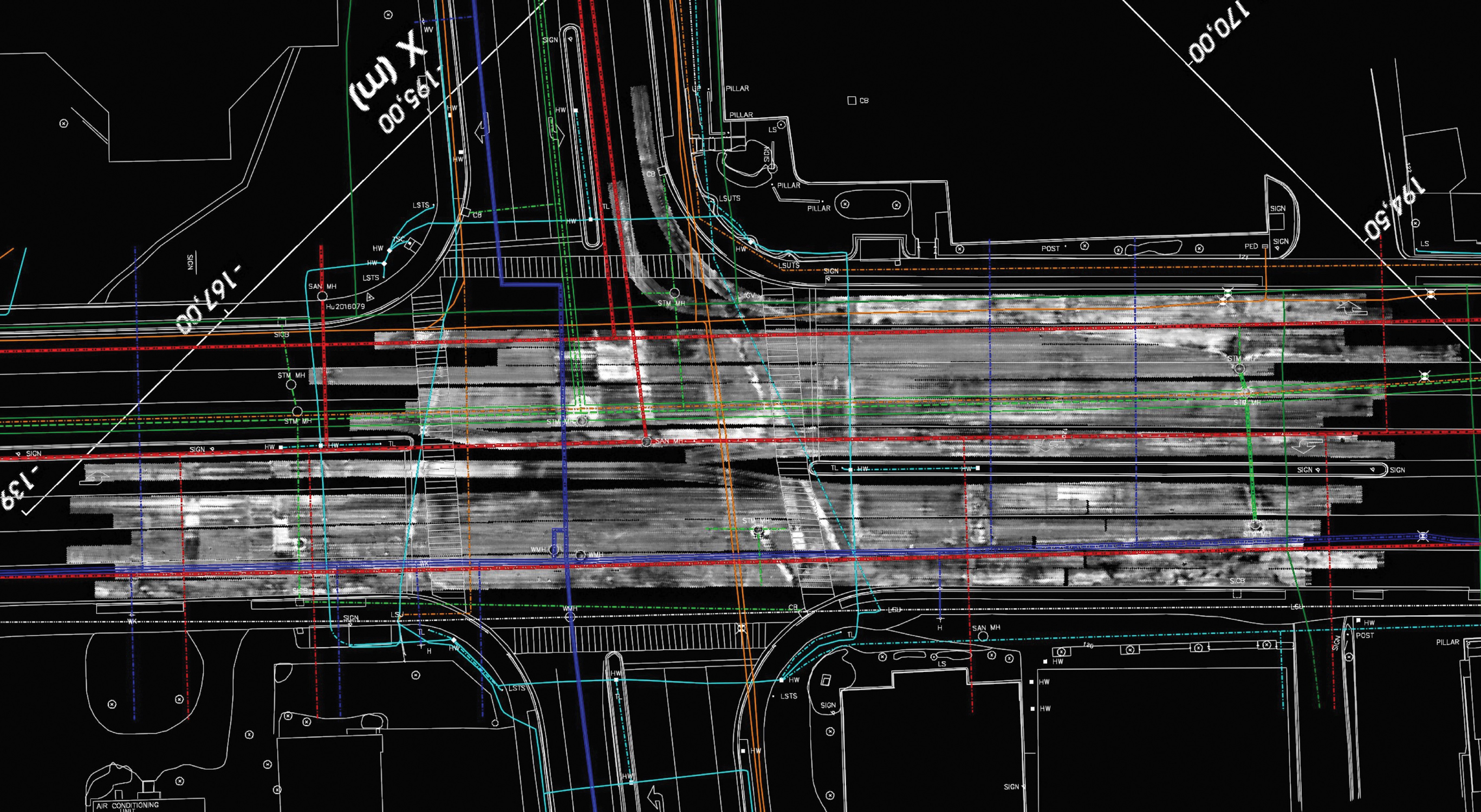
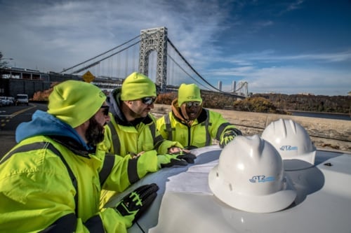
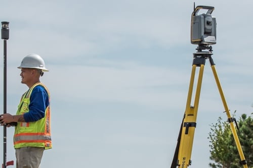
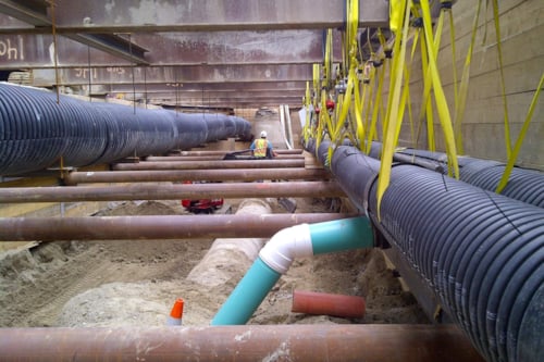
Underground and above‑ground utilities pose significant safety, schedule, and cost risks to infrastructure projects. To reduce these risks, T2 Utility Engineers (T2) applies professional engineering judgment, advanced geophysical and geospatial methods, and structured investigation processes to identify, characterize, and document utility infrastructure.
We deliver ASCE 38‑22–compliant Subsurface Utility Engineering (SUE) and modified utility investigations tailored to project scope, risk, and budget—providing reliable data for confident design decisions and proactive utility risk management. In addition, we provide As-Built geospatial and attribute data to develop or improve digital datasets for new utility installations. We use ASCE 75, the national as-built Standard, as the foundation to collect and document utility infrastructure location in support of utility engineering. These services are central to utility infrastructure damage prevention.

What We Do

T2 offers a full spectrum of utility investigation services. Our professionals review the requirements and site conditions that are unique to each project and recommend an approach to meet the needs of the project team. 

Core Offerings

  • Subsurface Utility Engineering (SUE) performed in accordance with ASCE 38‑22, which provides data which are gathered, analyzed, reviewed, signed, and sealed by a geophysically- knowledgeable professional engineer or licensed surveyor.
  • Modified Utility Investigations that utilize our utility knowledge, technology, and attention to quality data that meet specific objectives (budget, schedule, corridor constraints) without providing signed or sealed deliverables, when clients are satisfied with taking on more risk. 

Field Methods and Data Collection

  • Utility designating using appropriate surface geophysics (e.g., EM locating, GPR, multi‑channel GPR/MD‑GPR), with results surveyed to project control. In an ASCE 38 compliant investigation, this is part of the requirements for achieving Quality Level B utility presence and their horizontal positions.
  • Utility locating / vacuum excavation to expose utilities and record precise horizontal and vertical position. Within an ASCE 38 investigation, this supports achieving Quality Level A data at critical points.
  • As-Built records / ASCE 75 As Built Records Standard supports improved quality of as-built utility data records for utility infrastructure management based on precise geospatial and common attribute information. 
  • Targeted geophysical investigations for unknown utilities/anomalies: void detection, buried tanks/vaults, rail/track bed conditions, concrete scanning, archaeological geophysics.
  • Geospatial surveying and mapping: control networks, topographic and right‑of‑way surveys, UAS/drone LiDAR, terrestrial LiDAR, no‑entry confined space capture, and data models.

Analysis and Quality Deliverables

  • Utility conflict analysis and coordination with stakeholders, utility owners; development of conflict matrices and relocation plans.
  • Data governance and quality- Calibrated equipment, field standards, proper equipment selection, survey control, metadata, notes provide quality and clarity.
  • Design support for constructability and sequencing in utility‑dense corridors.
  • Deliverables structured for integration with CAD/BIM/GIS and common design platforms to support both design and construction workflows.

How Kiwa Delivers Value

Standards‑driven

Subsurface Utility Engineering (SUE) investigations conducted in accordance with ASCE 38‑22 when required; otherwise, tailored modified investigations with transparent, documented processes. The ASCE 75 As Built Records Standard provides the framework for accurate digital records during utility installation.

Fit‑for‑purpose investigation design

Scope and methods are aligned to project requirements, risk tolerance, budget, and site conditions.

Integrated technical methods

A full range of geophysical, geospatial, and utility engineering experience, equipment and technology, CAD processing, modeling, and analysis are brought together to support and achieve project objective.

Professional oversight

Licensed PEs/PLSs, geoscience professionals, and experienced Project Managers recommend most suitable approach, review data, interpret results, and sign/seal SUE ASCE 38 deliverables as appropriate.

Proactive utility conflict management

Early identification and planning coordinating with utility owners to avoid redesigns and field stoppages.

Quality and repeatability

Calibrated equipment, advanced technologies, documented procedures, and trained field teams deliver consistent, defensible results across projects.

Why This Expertise Matters

Unknown or inaccurately mapped utilities can trigger safety incidents, service outages, costly redesign, change orders, claims and schedule delays during project construction. By providing reliable, decision‑ready utility information early in design—through either SUE or modified investigations—T2 reduces uncertainty and utility-related risks, improves constructability, streamlines permitting, and helps keep projects on time and on budget.

Who We Serve

Engineering and design firms

Departments of Transportation and other agencies

Municipalities and public works

Utility owners/operators

General contractors

Private developers and alternative delivery teams (design‑build, CM/GC, P3)

Our services include

Not ready to get a quote?

Fill out our contact form and get in contact with our sales assistance department.

Frequently asked questions

What is Subsurface Utility Engineering (SUE)?

SUE is an engineering practice for investigating, identifying, characterizing, documenting; and determining impacts and analysis for existing utilities that may affect infrastructure projects. When performed in accordance with ASCE 38‑22, SUE specifies processes, documentation, and resulting Quality Levels (A–D) and requires deliverables to be signed and sealed by a licensed professional according to jurisdictional requirements.

What are modified utility investigations?

In a modified utility investigation, specific methods are selected based on site and client project requirements, without invoking the fully comprehensive ASCE 38‑22 scope. T2 clearly documents the results found under the defined scope, but does not sign or seal deliverables.  

How do SUE and modified utility investigations reduce project risk?

Both approaches provide utility information which allows clients to make informed decisions. Data and insights from T2 reduce the likelihood of utility strikes, service disruptions, redesigns, change orders, and delays. ASCE 38 is typically used for congested corridors, large complex projects, or where owner certainty and risk mitigation standards mandate it; modified investigations are frequently used to efficiently answer specific questions or support specific design plans.

What are the ASCE 38‑22 Quality Levels?

The ASCE Quality levels actually represent the degree of certainty of the data found in each specific segment. The Quality levels are specific to following ASCE 38 Standard. They have specific requirements and build upon each other, moving from least certain (QLD) to most certain (QLA).  Many SUE investigations target Quality Level B, with use of QLA in specific, selected locations. Deliverables provide detail on each utility segment along with notes, all signed/sealed by the professional in charge. 

•    QL‑D: Records/One‑Call information (lowest certainty).
•    QL‑C: Records + topographic survey of visible utility features.
•    QL‑B: Geophysical designating to determine horizontal positions, surveyed to control.
•    QL‑A: Vacuum excavation to determine precise horizontal and vertical positions at points of interest (highest certainty).

Note: Modified utility investigations should not use Quality Level language.

What is utility designating vs. utility locating?

Designating

Use of surface geophysics to infer utility presence and approximate horizontal position. Within ASCE 38 investigation, this information (supports QL‑B when surveyed to control.

Locating

Vacuum excavation to physically expose utilities at discrete points and measure precise horizontal and vertical positions and attributes. Within ASCE 38 specific requirements are used to define Quality Level A QLA. 

What geospatial and geophysical services does T2 provide?

As-built Records / ASCE 75

ASCE developed the As Built Records Standard ASCE 75 to provide a national framework for survey to be used in utility records drawing to capture and retain data for new underground or overhead utility location data during installation exposure. The intent is to provide precise geospatial attribute data for digital records.

Geospatial

Boundary/ROW, transportation surveys, UAS/drone LiDAR, terrestrial LiDAR, no‑entry confined space capture; deliverables aligned to CAD/BIM/GIS.

Geophysics

Archaeological geophysics, void detection, buried tank/vault locating, unknown anomaly detection, rail/track bed assessments, concrete scanning.

A group of T2UE Engineers having a meeting at a client site

T2 Utility Engineers

T2 Utility Engineers specializes in services to reduce the risk of existing underground and above-ground utilities for infrastructure projects.