
Is LiDAR the Future of Surveying?
LiDAR surveying boosts 3D mapping speed and accuracy, while traditional methods remain essential for precise, cost-effective results.
The field of surveying has come a long way since the days of traditional survey methods. With great advancements in technology, the industry has seen a significant shift toward using LiDAR (Light Detection and Ranging) for 3D modeling. LiDAR surveys have revolutionized mapping with laser technology, creating precise 3D models of landscapes and structures.
Capturing Vast Amounts of Data in Record Time
One of LiDAR’s standout advantages is its ability to quickly capture large amounts of data. Traditional surveying methods often require considerable time and manpower, particularly for large-scale projects.
LiDAR-equipped systems, however, can cover extensive areas in a fraction of the time, without compromising precision.
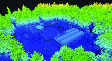
A 2019 study by the American Society of Photogrammetry and Remote Sensing (ASPRS) showed that LiDAR surveys provided time savings of up to 40%, while also improving accuracy by 2 to 5 times compared to conventional methods.
Are There Limitations to LiDAR Surveys?
While LiDAR’s versatility extends the traditional applications of surveying for fields such as engineering, forestry, urban planning, and archaeology, it does have limitations:
- Vegetation: Dense vegetation can prevent the laser’s penetration therefore interfering with LiDAR’s accuracy.
- Weather Conditions: Snow, ice, rain, and fog can affect LiDAR data collection. It is difficult to fly the drone in adverse weather conditions as well.
- Cost: High equipment and processing costs may be prohibitive for smaller firms.
- Permission: Access to certain areas may require regulatory approval or landowner permission, which can delay data collection.
- Expertise: Skilled technicians and advanced knowledge are necessary to interpret complex LiDAR data, making it less accessible for firms without specialized personnel.
A Balanced Approach: The Future of Surveying
Despite LiDAR’s significant advantages, it is not expected to fully replace traditional survey methods. Instead, a complementary approach is emerging, which integrates both LiDAR and traditional techniques to maximize accuracy, flexibility, and cost-effectiveness.
A key part of this balanced approach involves selecting the right combination of methods based on the specific needs of a project. For instance, LiDAR excels in large-scale topographic surveys, especially in areas with dense vegetation, as its laser pulses can penetrate through foliage to map the terrain beneath. On the other hand, traditional ground-based methods, such as total stations or GNSS (Global Navigation Satellite Systems), are more effective for small areas requiring precise boundary measurements, particularly in urban environments where reflective surfaces may interfere with LiDAR data.
In practice, many projects integrate multiple surveying tools:
- LiDAR for rapid, high-precision terrain mapping, especially for larger and inaccessible areas.
- Photogrammetry for detailed visual imagery, offering a cost-effective alternative when high accuracy is not essential, especially in construction projects with minimal vegetation.
- Ground-based methods like total stations or GPS to capture exact boundary points or detailed elevations in more confined or complex areas.
This combination ensures comprehensive data collection, leveraging the speed and efficiency of LiDAR with the pinpoint accuracy of traditional tools, particularly in scenarios that demand more detail or verification. For example, in construction site preparation, LiDAR may provide an initial broad scan, while traditional surveys refine measurements for precise placement of utilities and structures (Advanced Navigation, ECI3D)
At Kiwa T2, we employ multiple surveying techniques to ensure the most accurate results. By integrating LiDAR data with ground-based measurements, our experts enhance precision and reliability across projects. 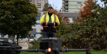
If you require professional surveying services, book now or contact us today to learn more about how we can assist with your project!